About
HabitatMap

HabitatMap is an environmental technology non-profit building open-source, free, and low-cost environmental monitoring and data visualization solutions. Our tools empower organizations and community scientists to measure pollution and advocate for equitable solutions to environmental health issues. We focus on low-income communities and communities of color living with disproportionate environmental burdens.

Our mission

We make technologies accessible so communities facing disproportionate environmental burdens can advocate for equity and improved quality of life.

Airbeam
Michael Heimbinder

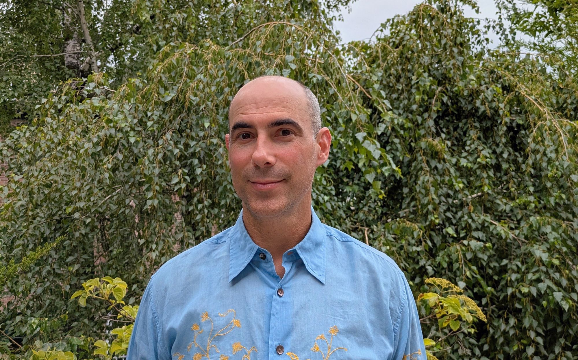
Founder & Executive Director

Michael Heimbinder is an information designer, community organizer, and educator.

Since launching HabitatMap in 2006, he has worked with dozens of community-based organizations and schools to create planning and advocacy maps that publicize the issues they care about most.

Learn More

HabitatMap
in the News

From OPEN SOURCE STORIES:

“If you have a low cost instrument that's easy to use, then all of a sudden science becomes something that everyday people can do.”

From POPULAR SCIENCE:

“Low-cost monitors like the AirBeam enable pollution-impacted communities ‘to generate their own data based on their experience of — and knowledge of — pollution in their vicinity,’ she added. ‘It empowers the communities with technical information, often the missing piece in fighting pollution, and assists them in holding regulatory agencies and polluters accountable.’”

From THE NEW YORK TIMES:

“I do believe in the power of the group to change policy,” he said. “If we’re measuring air quality, then we can say, ‘Look, we have real evidence here. You have to do something.’ ”

From ENVIRONMENTAL FACTOR:

“This program provides structure to build environmental health literacy, technical skills, and collaboration between scientists, residents, and environmental justice organizations," said Wendy Gutschow, CEPHE community engagement administrator. "[It] teaches youths that resources exist…gives them the tools and knowledge to influence policy, and encourages them to be active in their communities.”

From CITYLAB:

“we’re really looking at personal exposures, what is it like for the person who’s walking to work, at work, at school? What kind of air are they breathing in on a day to day basis?”

From ADAFRUIT BLOG:

“Air Keepers as they call them, are not just students. The program is community-based so ordinary citizens can learn about their environment. It’s a great concept bringing together the issues of air quality, health, climate change and the power of advocacy.”

From WNYC:

“It’s less important to necessarily say, ‘What’s the performance of this specific instrument?’ and more important to look at it in the aggregate and say, ‘How can we combine low-cost, citizen-science-collected data with high-end-instrumentation data to improve the accuracy of both?’”

From ST. ALBERT TODAY:

“Cheap portable sensors like the AirBeam could help focus efforts to track air quality. If a group were to make a bunch of them available to borrow, parents could wear them while biking or driving around town, and students could use them to track emissions from cars idling at their schools. Eventually, a map could be compiled of pollution hot spots in the city, showing where the problems are and the possible causes of them.”

From ATLANTIC RE:THINK:

“If you wanted to go measure air quality, the instruments run by the state are $15-20,000, and so we said how can we solve this problem, how can we bring down the cost, how can we make it easier to use? And that's what AirCasting was developed to address.”

From FAST COMPANY:

“Using AirCasting – an open-source air-quality monitoring and mapping tool from HabitatMap–the teens were able to determine that PM 2.5 concentrations were five times higher along the Gowanus Expressway than the citywide average. And in doing so, they acted as citizen scientists.”

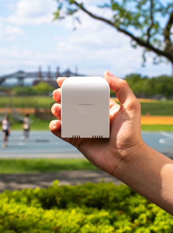
The AirBeam measures particulate matter with proven accuracy and when used in conjunction with the AirCasting platform - or a custom solution - helps community-based organizations, educators, academics, regulators, city managers, and community scientists map air pollution and organize for clean air.

Learn More

AirCasting is an open-source environmental data visualization platform that consists of an Android app and online mapping system and is one of the largest open-source databases of community-collected air quality measurements ever created.

AirCasting Maps